Meet Report: May 2024.

This was the fourth in a series of YRC meets in the Bolivian Andes. Whereas the previous ones in the Apolobamba 1988, central Cordilleras Real & Cocapata 1999, and Quimsa Cruz 2010 were exploratory, the first two making first ascents, this fourth one visited more-easily accessed, higher peaks closer to La Paz.
We started off with eight members including lots of Smiths and Richards: Michael, Richard & Fiona Smith, Steve & Wendy Richards, Richard Taylor, Toby Dickinson and Steve McCain. Unfortunately, we ended up with only seven. When UK PM Rishi Sunak unexpectedly called a General Election, Toby had to dash back to London. He had completed all the acclimatisation hillwalking by then, and if only Rishi had hesitated another two days, then we would have been out of contact in the mountains and Toby would have reaped the dividend of all that preparation.
A fuller description of the meet’s activities will have to wait until the 2024 YRC Journal but this brief report will give a good idea of what happened. This is in several sections: La Paz, Lake Titicaca, Peñas rock climbing, Condoriri basin, Huayana Potosi, Potosi mine, Cuzco, Salar & Atacama.


La Paz
The city of La Paz is in a bowl ranging in height from 3,640m to 4,150m. Arriving by plane suddenly unacclimatised at over 13,000ft made it a struggle even to climb the steps up to our hotel. There was a noticeable improvement over the next few days as we explored the city. There were plenty of cultural events on the streets and a network of gondolas to move us about the city.
A couple of walks took us to a high col on the Devil’s Molar (Muela del Diablo, 3825m), and Chacaltaya, 5435m, an hour’s taxi ride away. Those who had previously visited the area noted many improvements in cleaner city streets, improved hygiene in food sales, better public transport vehicles, and improved housing, but also greater urban sprawl and the establishment of a much larger independent El Alto city on the altiplano by La Paz.


Lake Titicaca
A minibus ride northwest, across the Tiquina Straights and up the Yampupata peninsula allowed us to walk a pre-Columbian trail for a boat-ride over to the Isla del Sol. Over two days we walked the length of the island with the 6,000m snowy peaks of the Cordillera Real (Royal Range) lined up to our right.


From the island’s northern tip it was another boat journey back to Yampupata and the minibus to Copacabana Gloria Hotel for a few nights, and acclimatising hillwalking between there and the Peruvian border.
From these tops we could see clearly Sajama to the south (visited in 1999) and, a little hazy to the naked eye, the Apolobamba to the north (visited in 1988). They are over 400km apart.


It wasn’t all walking. Some found time to watch a local women’s football match, play mini golf, take out a squeaky pedalo, help harvest (yam-like) oca, or visit the Isla de la Luna. It was here that we lost Toby to the General Election following the surprise announcement.
Peñas rock climbing
The next stop was a subsidiary line of rocky tops off the eastern tip of Lake Titicaca. A short walk from a pleasant hostel in a sleepy Peñas were scores of crags with bolted climbs. These gave an afternoon’s entertainment and, the following day, a morning’s hillwalking.


Condoriri basin
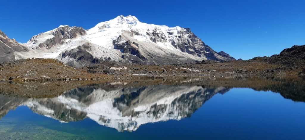
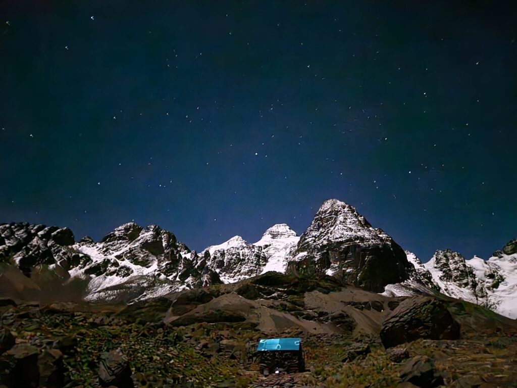
That afternoon, from the Rinaconda roadhead, it was a short walk up past Chiar Khota lake to the Condoriri base camp. Night time temperatures fell to -11°C, whilst each day llamas, alpacas, Andean geese, horses and the occasional donkey grazed the slopes around the camp alongside caracara, glacier finches, tyrants and viscacha – a truly magical setting. Our cook, Lucretia, had a hut for preparing meals which were served in our mess tent by Pablo. Ascents were made of 5350m rocky Pico Austria, 5349m glaciated Cerro Tarija, and 5100m scenic Paso de Condoriri. The younger members went to a glacier snout to practice ice climbing. On these excursions, all found the altitude a challenge but inspired by the spectacular mountain vistas, pushed through the difficulties to enjoy truly memorable mountain days.


Huayna Potosi
This 6080m peak was the final mountaineering objective. After being dropped off at the 4700m Zongo pass (Mt Blanc is 4807m) we relaxed in a refuge. The next morning, a walk along an aqueduct gave views of the mountain with its glaciers steeper than on earlier visits as they had retreated. That afternoon a rock ridge was taken to reach a higher small refuge at 5100m. The weather was milder here but still cold as we started out at 4am, climbing up to reach a glacier which was followed over a ridge to the right, all the time threading through crevasses on good snow bridges. Time and altitude proved difficult hurdles, but four of the team eventually reached the small summit after a series of steep and relentless zig zags up the flank of the final ridge. They were rewarded by far reaching vistas, it was a new high for all, both literally and emotionally. Digestive complaints robbed two others of that last slope and another made the first 50m of it. Another day to remember in stunning mountain scenery – this one with 12 hours out on the mountain followed by a celebratory beer and a ride back to La Paz.


Potosi mine
Richard Taylor, Richard Smith and Michael Smith travelled by overnight bus over 500km south to Potosi to go underground into the Cerro Rico silver mine – the main source of Spain’s colonial wealth and a substantial part of ours too through the actions of our privateers in the Caribbean. Infuriated by a government level change in the regulation of the mines, the miners were protesting in the main square, launching exploding rockets and sticks of dynamite. These three members also visited a Devil’s cave, a convent, two churches, and bathed in water from steaming hot springs.


Cuzco
Wendy and Steve Richards crossed into Peru and visited the Uros people on Titicaca’s floating reed islands near Puno before staying in and around Cuzco for a festival, the extensive Sacred Valley ruins, and famous Machu Picchu. They flew home from Lima.


Salar & Atacama.
Richard Taylor and Steve McCain had a week travelling through the Uyuni salt flats, over the western cordillera passing Ollaque (climbed on our 1999 expedition) and into the Atacama desert to visit the Tatio geysers. These are vast memorable and distinctive landscapes, separated by long distances requiring three long overnight coach journeys and other minibus excursions.


All arrived home safe though Lima airport’s landing lights failure delayed two members’ flights home by a day. Thanks go to Andean Summits for logistical support. The guides, minibus driver, cook team, donkey drivers, refuge & hotel staffs all helped to make this a memorable trip. We recommend travel to and around Bolivia for its lack of bureaucracy, open spaces, accessible attractive mountains, good weather, diverse interesting landscapes, and its helpful welcoming people.

Over its 200 years of independence, Bolivia has seen almost 200 coups d’état or revolutions. The most recent (short-lived and failed) one instigated by General Zuniga was just a few weeks after the last of us returned home.
So, given all these difficulties with travel, unrest, diets, thin air, harsh climate, demanding terrain, intense UV, unfamiliar situations, etc., not to mention the cost, why do we bother with such trips rather than sticking with European ranges? The amazing sights, sounds and smells; the sense of achievement in facing up to the greater challenges; the broadening of experience in meeting people of other cultures and seeing how they solve differently the problems we have in common; and the deeper relationships that develop through spending weeks working together with other members, are some of the rewards.

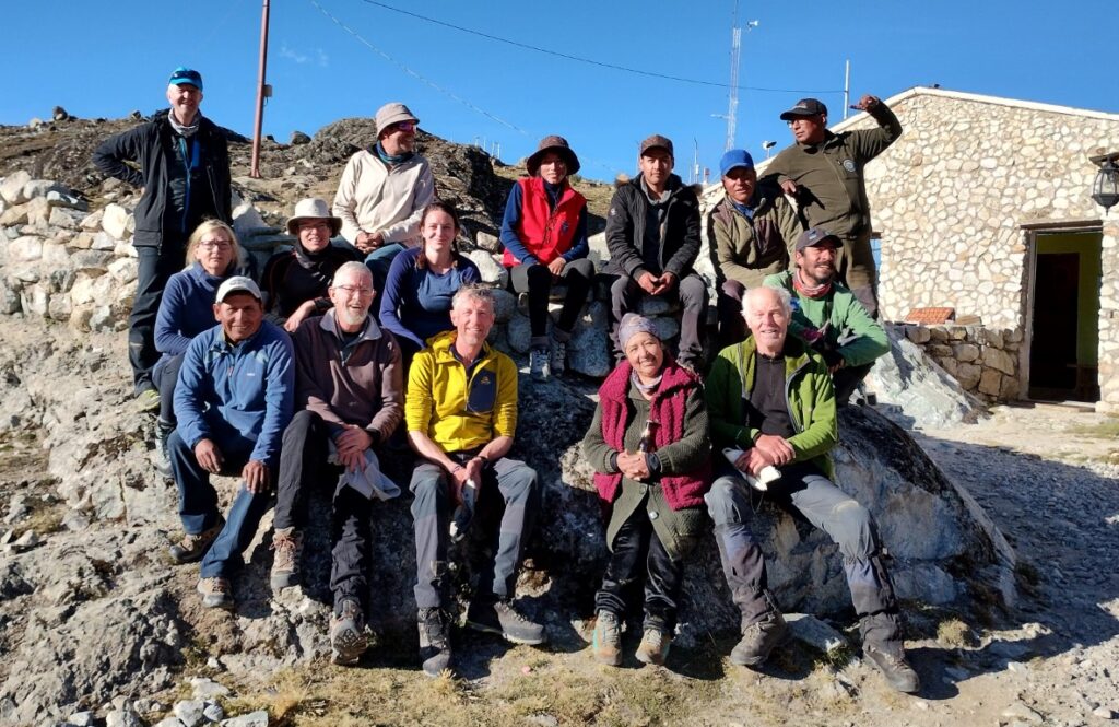
L-R, rear row; Steve McCain, Jose Camarlinghi (Andean Summits), Techy (aspirant guide), 2 porters and the refuge owner. Middle row; Wendy Richards, Richard and Fiona Smith, cook’s driver. Front row; Sixto (driver), Michael Smith, Steve Richards, Lucrecia Chambi (cook), Richard Taylor.
Leave a Reply