Swedish Lapland
Derek A. Smithson
I wrote, ‘Should we destroy all guide books and detailed descriptions of mountain areas so that all can have the pleasure of discovery’ and even in 1976 I believed there was a case to be made. I wrote this when recording outings in northern Sweden about a mountain area that was so good I wanted my friends to know. When considering access from the U.K., I remembered that George Spenceley wrote an article on crossing from Narvik into Sweden. Spenceley had actually traversed the mountain I had only attempted and his article freed me to write my story, which never got finished, but which I titled, ‘Three Weekends in Lapland or Sixteen Years After Spenceley’. Here it is.
During a four week period in September 1976 I was determined to have a closer look at the mountainous area near Kebnekaise, the highest mountain in Sweden. Lulea, where I was working, is a four-and-a-half hour drive from Nikkaloukta, which is a normal starting point for the Kebnekaise region. So I needed more than a minimum weekend, and I needed a new rucsac to carry the additional clothing and bedding I would require. The climate there in September is drier than Britain, but a lot colder. Above about 500m. it would snow rather than rain, but the snow would soften in the sunlight.
The first weekend had to be short, so I drove the 300km. to Kvikkjokk on the Friday evening. I knew there was an interesting mountain close by. My previous attempt to reach it had been frustrated by the ice on the lakes having partially melted. I could have walked on the full ice-cover and in the summer season there are boats for walkers to use to cross these lakes which interrupt the Kungsladen (a long-distance walking route). This was my first attempt to use a boat so, of course, I missed it. Missing the first of the three daily boats meant a very short day on the mountain, so I abandoned my plan.
I set off walking along the bank of a beautiful river until the path began to fade. The scene would have suited a travel-agent looking for advertising pictures. A wide river with rapids, lined with a mixture of fir-trees and birch trees with a back cloth of mountains covered with new snow, all lit by sunshine from a clear blue sky. That was what made me follow the river. Then, walking by compass through the forest, I found a logging road which leads towards the mountains of the Sarek region, said to be the last great wilderness in Europe. Eventually the road came to a river I could not cross even though the road continued on the other side. I continued walking along a faint riverside path until the character of the river changed completely and it became part of an elevated lake system. The path stopped where about ten boats were either moored or on the bank and I concluded that this must be the route to a Lap village only accessible by boat in the summer. I made an attempt to see more of the lake system but the dense undergrowth among the trees made this hard work and my view of the surroundings was very restricted.
My second weekend was also based on Kvikkjokk. The plan was to walk north along the Kungsladen to make a first visit to a Tourist Stuga (mountain hut). I was also testing my new rucsac which was my first pack frame with a waist band and I thought that would make weight carrying easier. The hostel at Kvikkjokk was full, but they managed to find a space for me for one night. It was sleeting when I got up on Saturday, but cleared sufficiently by nine o’clock for me to start. The walk was along a clearly marked path undulating gently through the forest. Where the ground is marshy there are split logs laid which stop one sinking in, but I was told that these logs are laid to conserve the land, not to help the walker. I met two hunters who carried both guns and cameras. One of them was Pell the owner of the hostel, whom I had met before but who spoke no English. We tried a little sign language and I was interested to see that they both carried rolled reindeer skins for mattresses. Pell was a Lap not a Swede. The trees changed from firs to birch before I passed the turn off to a Lap village and to the Sarek National Park. The Sarek mountains are a full day’s walk from Kvikkjokk and there are no stugas and few paths. I joined up with an English speaking Swede about here and there was now 6 to 9 inches of new powdery snow. We could see the hills over the small birch trees but with the low cloud the outlook was threatening rather than inspiring. When we stopped to eat we met two more Swedes who had been camping. Wearily we plodded on, through a gate in a deer-fence and down to the stuga beside the lake.
Only one part of the stuga was open, because it was out of season, but before we took our wet boots off to enter we went to chop wood that would dry in the hut during our stay and replace the wood that we burned. My companion also explained the sign boards which directed us to where we collected drinking water and where we disposed of waste water. The building that was open consisted of two similar rooms, each with three double tier bunks, a wood burning stove for both cooking and heating, and some pots and pans. The stove was very effective for both cooking and heating, including drying our clothes. We were very comfortable but only had hand torches for light, so we talked a lot and went to bed early. My companion had been a meteorologist who was planning to go to college to learn architecture, but at present was wandering. He was very good company and I was sorry not to be continuing north with him. The following day was sunny with big white clouds in a blue sky. The rain, late the day before, had beaten down the snow so that the return was quick and easy. My only problem was the new rucsac whose belt was never designed to support any of the weight.
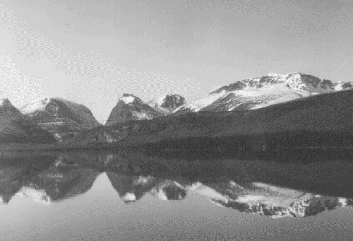
For my final trip I took two days of my annual holiday and stayed the first night in Kiruna, which is only about 70km. from Nikkaloukta where I would leave the car. From there it is about 20km. walk to the Kebnekaise Fjallstation along a flat bottomed valley. The forward view on this walk changes slowly, but always the mountains are beckoning. On this occasion the views were incredibly beautiful, for, to translate a Swedish saying, ‘the mountains were on fire’. This means that the birch trees and the mountain shrubs had their autumn colours of rich reds and browns with occasional birch still yellow or green. To this was added a back-cloth of mountains with new snow on them and a clear blue sky. Just before the fjallstation, I turned right up a side valley which rose steadily to take me past the foot of three glaciers and up to Tarfalstugan, a mountain hut. There was a research station at the foot of these glaciers, but there was no sign of life and I continued over the snow. This was a different world. All snow, ice and rock. The lake beside the hut was only lightly frozen at the edges, but it felt very, very cold. The hut had a furnished living room and two bedrooms, but as I was alone in the hut I only used one of the bedrooms. The stove was so effective that I had to open the door into the living room to keep cool. The next morning I was out by 07.00 into a bitterly cold wind, but with a clear sky. I spent over an hour stumbling round the lake on a boulder-strewn slope and then reached the ridge of moraine at the edge of the glacier which led almost up to the saddle below the rock ridge I hoped to climb. The rock ridge led to the summit of Kebnepakte, 1990m., which is one of the summits of Kebnekaise. The route up the moraine was ideal and the short rock wall at the top only marginally harder, but on the saddle the wind was diabolical. It blew hard enough to upset the balance when moving, but in addition it was so cold that the brain felt numbed and I crawled down below the rock wall. Once out of the wind the decision to go down was unavoidable. The rock ridge looked like easy climbing, but it was definitely not a walking route and I was alone. I packed up and walked down to the Kebnekaise Fjellstation. There are easier routes from there.
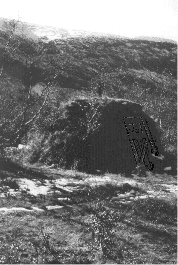
The fjellstation is extensive. It includes a main building with a cafe, showers, sauna and bunks with sheets. There was a normal stuga and additional hutments for the staff but the most unsightly was a barrack-like building which was said to be used as a mountaineering school and looked more like a military establishment. There were also a number of lap huts which are constructed of turf over a waterproof layer of birch bark. They each had a stove-pipe chimney and looked as though they would sleep about four people. The real luxury was electric light and beer at the cafe. Conversation with some Swedes in the stuga revealed that they also worked as consultants for the same client as I. Two of their party were totally inexperienced and were expecting to be taken up the most easterly of the two recognised routes, by the third member of their party. This route includes a short stretch of climbing, crossing a glacier and walking up a permanent snow field, a more interesting route than I was planning, so I was pleased to be asked to join their party. The Swedish leader of the party went and borrowed crampon for all of us, but only one ice axe, which left one of the Swedes with only a staff. I was made uneasy, early the next morning, by seeing our leader drink beer for breakfast, finding myself volunteering to carry a rope and finally our losing the path on the way to the small valley which is the true start of the route. Our upward progress was very slow with many stops for drinks, using an ingenious meths stove (my first sight of a Trangia stove). We roped up for the snow field which was hard snow at a steep enough angle to be interesting and to give that special joy from the snow, the sunshine and the view. Across the glacier we could see a snow ramp leading most of the way up a cliff which was topped by a lesser summit, Toppstugan. I got them across the glacier by the use of the phrase ‘let’s go and have a look’, but the frozen snow on the steep ramp, the cliff, and the cornice stopped the party at the beginning of the snow ramp. My companions waited patiently whilst I played on my borrowed, ten-point crampon, but the angle made step cutting desirable to relieve the ankles, and there was a layer of powder snow higher up, and there was the cornice, so I didn’t go far. The party descended slowly and the great thirst could only be relieved by beer at the fjallstation. On the Sunday I had to return to Lulea, but only had a simple walk to Nikkaloukta so I went to do an easy climb on the local practice crag. This had all the looseness of a virgin crag with a layer of small stones on every horizontal surface. Perhaps there was not much practising done. The walk back was lovely and I met some children, about ten years of age, who changed from Swedish to English so that they could talk to me. I felt the stupid ignorant foreigner that I am. After all my travels and all my years I still only speak English!


