Meet Report: 17-26 July 2020.
Collectively 50 of us walked and ran 1165 miles (1874km), cycled 413 miles (665km) and there were 122 visits to trig points. As with the Covid 19 statistics, the figures are known to be far higher. Kayaking in Sweden and caving in Yorkshire were also on the agenda. Congratulations to all who made the effort; if anyone has been left out or misrepresented please let the Meets Secretary know. After the marathon effort of compiling this list he may or may not take any notice!
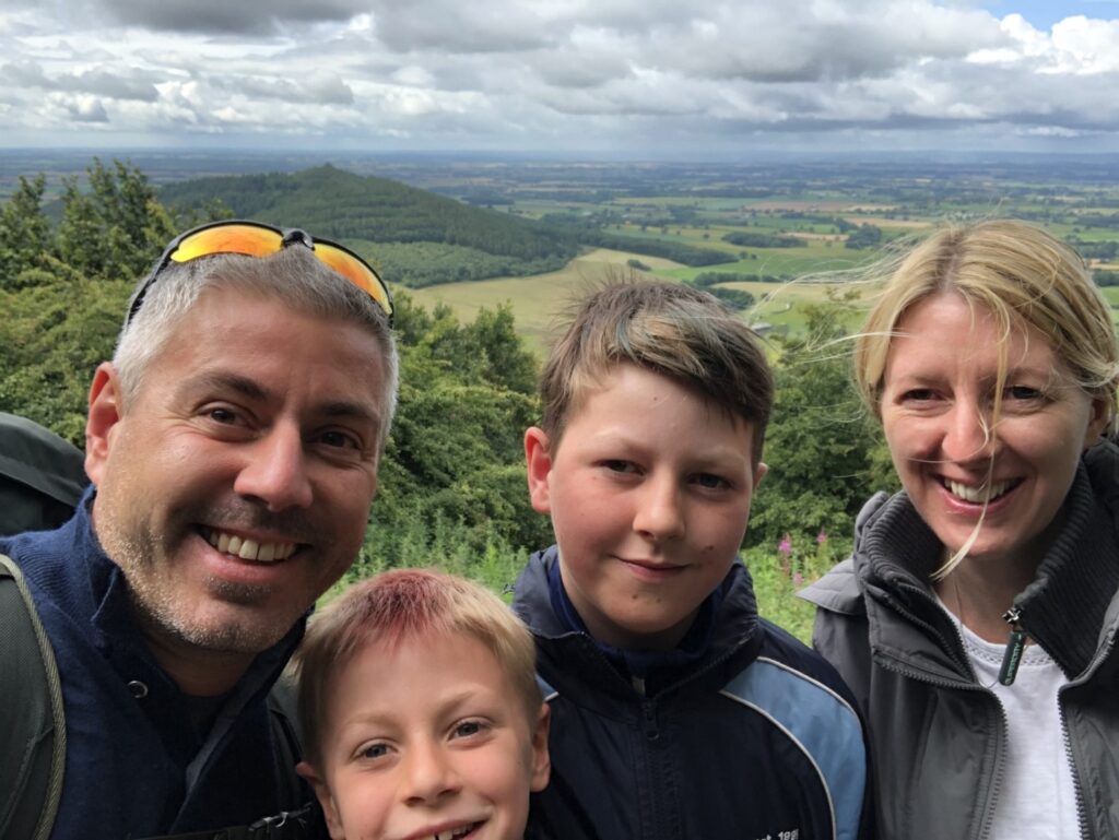
Dave and Fiona Booker-Smith 🚴 49.7 miles 80km 🚶🏽 20.3 miles 32.7km 🏃♀️ 28.1 miles 45.2km 2 trigs
July 18. We did a bike loop between Selby and Fairburn which was 80km. Very flat but nice and quiet roads.
July 19. We did a good walk up Pen-y-ghent, Ingleborough and then down to Trow Gill, starting and finishing in Horton. Once we got away from the crowds of 3 peakers it was lovely. Finished with an ice cream for all three of us (including Bailey, the dog).
July 21: Fiona ran around Morley, Leeds. 10km, 69m↑, 0.9hr.
July 25: Fiona ran the middle part of the Leeds Country Way. Headingley, Eccup, Bardsey, Thorner, Barwick-in-Elmet, Garforth, and Swillington. 35.1km, 443m↑, 4.24hr.
July 26: Dave and Fiona walked the Holmfirth Loop: Holmfirth, Brockholes, Top o’t Hill, Biggin, and New Mill. 12.3km, 397m↑, 2.85hr.


Mick Borroff 62.5 miles 100.5km 3 trigs
Thursday 16th – a quick pre-meet hike from Buckden to visit the peat hags enveloped in thick mist at the summit of Birks Fell – a Yorkshire 2000ft summit I had not been to for years. 10.5km, +461m, 3hr 45min.
Saturday 18th – up to the head of Wharfedale for a walk from Fleet Moss over Drumaldrace and down to Gayle in improving weather, returning up the Pennine Way via the trig point on Dodd Fell. Amazing number of voles/mice in the grass on the summits, but no predators in evidence. Just three butterflies seen all day as the vegetation began to dry out – all ringlets. 15.7km, +576m, 3hr 50 min.
Monday 20th – a leisurely day out for a pleasant change with John Sutcliffe and a geologist friend Roger with his family, starting from Malham, taking in the Cove, the Watlowes, Water Sinks, Pikedaw Hill and its calamine mine, picking up odd bits of blue (azurite) and green (malachite) copper ores from the old dump and down via the neatly-walled adit portal dated 1872. 10.9km +424m, 3hr 40min.
Tuesday 21st – a great walk with Richard Taylor and Peter Chadwick from Cotterdale to three more 2000ft summits: Great Shunner Fell, Hugh Seat and Sails. Good weather and far-reaching 360 degree views extending to the Galloway Hills and Scafell, Howgills and a huge number of Dales tops. Also visited Ure Head to see the birth of the infant river. Saw a buzzard and a short-eared owl hunting voles. 17.6km, +629m, 4hr 45min.
Friday 24th – a longer walk with Rory Newman and guided by David Hick starting from the Kilburn White Horse car park. Lovely day, great views especially from the John Bunting Memorial Chapel at Scotch Corner over the Vale of York to the Pennines. Plenty of butterflies to be seen enjoying the sun, and we had ice creams to finish. An excellent day out on the western border of the North York Moors. 28.8km, +700m, 6hr 30min.
Sunday 26th – a round of Harland Hill was chosen as a quiet outing from Carlton in Coverdale over to Waldendale and back via Horsehouse and the River Cover in rather mixed weather, but saw a short-eared owl at close range and three red kites – I hope they keep well away from the gamekeepers! Some lovely old hollow ways and ancient cart tracks on the route, but no trig points though. 17km, +647m, 4hr.


John Brown 18 miles 28.5km
17th July. I walked from home at Finedon, Northamptonshire, setting off through our pocket park which is old industrial land that was part of Northamptonshire’s iron industry.
Although the suggestion was to incorporate a route that took in trig points, they are a bit thin on the ground here so I decided to use the old Churches as fixed points on the walk.
The first church I came to was All Saints Church in Great Harrowden. This church has been around since C1300. It is built of ironstone as depicts the natural stone of the area. I continued west along a bridleway skirting the town of Wellingborough then north west through the fields around the manor of Hardwick. The rape seed harvest was attracting the red kites and there must have been at least 20 roving across the sky, great to see.
It was nice to find a bench and peace for lunch in the church yard of the 14th century St. Andrews Church at Broughton.
The next part of the walk was south east through some open countryside with plenty of grassland and predominantly sheep grazing, to the next village of Pytchley. The All Saints church here has its origins in the 12th century.
My next stop was St. Peters Church in the parish of Isham. This also has its origins in Norman times. Homewards then, passing along the flood plain of the river Ise, crossing where the old Finedon Mill used to stand.
My walk took about 7 hrs and was just short of 18 miles, I hardly saw a soul during the day but heard plenty of black caps and yellow hammers so had a very good day indeed walking through the history of my part of Northamptonshire.


Kevin Brown 🛶
We’ve just spent a few fine days out in Gryts archipelago kayaking and I attach a few photos. The Swedes don’t really do trig points but when they do build a cairn then it’s big! We visited the iconic lighthouse at Häradskär, the first in Sweden with a rotating light. Next week we head North to the High Coast, maybe some walking but of course some good paddling too.


Ged Campion 10.75 miles 17.3km 2 Trigs
21st July. Place Fell, Ullswater 7.1KM.
24th Juy. Blencathra via Hall’s Fell Ridge 6.2Km
26th July. Fountains Fell. Rough Close Farm to New Year Pot. 4Km (plus some caving)


Esther Chadwick 12 miles 19.3km 2 Trigs
I was in Yorkshire at the weekend and managed to squeeze in 12 miles clockwise in the loop from Kettlewell to Buckden Pike and Great Whernside on Saturday 18th. In the company of Lloyd de Beer and some friends, it took a relaxing seven and a half hours. Rain and mist gave way to views in the afternoon.


Peter Chadwick 10.94 miles 17.6km 1 Trig
Tuesday 21st – a great walk with Richard Taylor and Mick Borroff from Cotterdale to three 2000ft summits: Great Shunner Fell, Hugh Seat and Sails. Good weather and far-reaching 360 degree views extending to the Galloway Hills and Scafell, Howgills and a huge number of Dales tops. Also visited Ure Head to see the birth of the infant river. Saw a buzzard and a short-eared owl hunting voles. 17.6km, +629m, 4hr 45min.
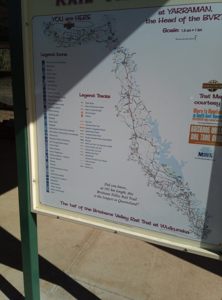
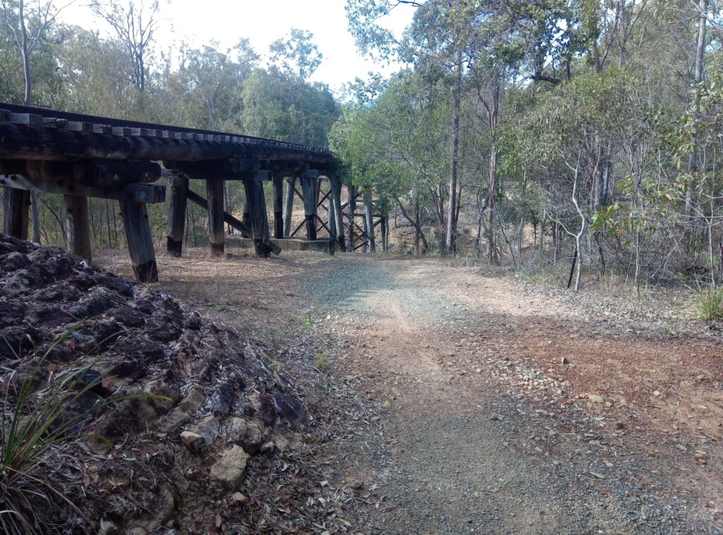
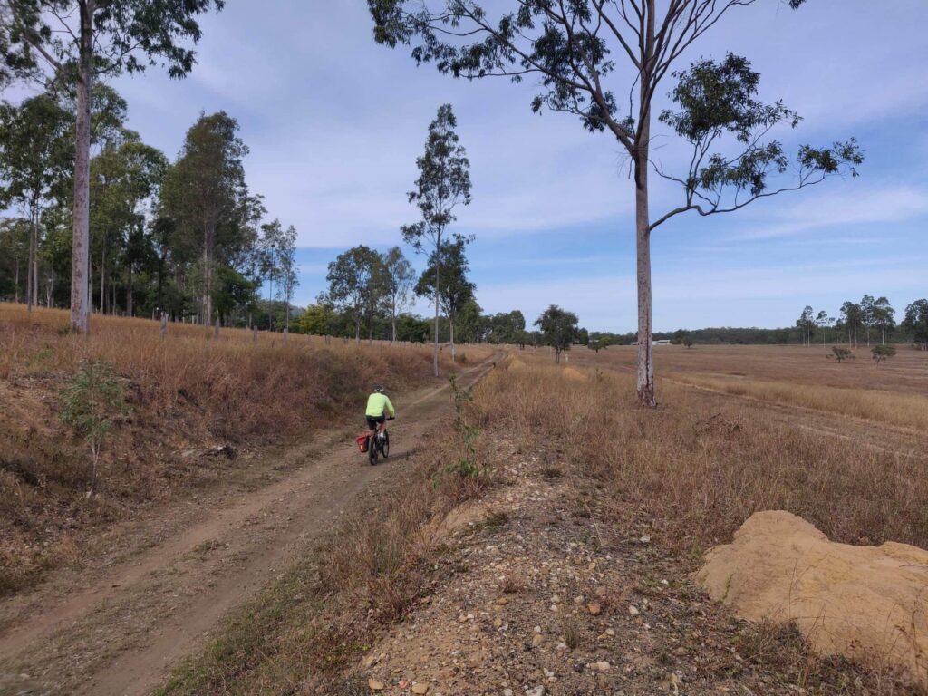
Barry Dover 🚴 104 miles 167.5km
Completed over two days with an overnight stop in Toogoolawah, Eric (eldest son) and I cycled the old Brisbane Valley Rail Trail (BVRT); Starting from the top (highest point) at Yarraman, it is a bit challenging in parts as non of the bridges are useable thus having to drop down into creek beds and back-up again; fortunately for us (not the farmers) most were dry, a few had just a trickle in them. A couple of them beat me and I had to walk the bike up the exits. Some of the latter stages were well maintained with rolled road base gravel, the last section concreted.
Paul Dover 🚴 58 miles 93.3km 🚶 29 miles 46.7km
Friday 17th July. Anne and I did a 3 mile walk round Oakington and I did an 8 mile walk the following day on the Royston Downs which included the highest point in the area, Therfield Water tower 168m. Not a trig point, we only have spot heights!
Tuesday 21 July. 12 mile walk with Richard Dover on the Ivinghoe Downs part of the Chilterns, climbed Ivinghoe Beacon (233m). It was a walk of contrasts, open Downs, ancient and managed forests, valleys of arable fields, charming woodland cottages at Little Gaddesden and pristine golf courses.
Thursday 23 July: 8 miles of walks with Richard Dover, Anne and Ann at Stowe Park, Buckingham, round the lakes, forests, parkland with numerous historical architectural temples and monuments.
Friday 24th July. 58 mile cycle ride from Oakington (8m) via Cambridge, to the chalk scarps east and south, passing Balsham (116m) Linton, Hadstock Common (112m) Saffron Walden, Strethall (91m) Fowlmere, and Madingley (62m). An interesting undulating ride with good views of the surrounding countryside.


Richard Dover 🚶🏽 20 miles 32km 🚴 62 miles 99.8km
Friday 17th; Cycle ride (20 miles) from home through the villages of Radford, Rouse Lench, Ab Lench, Church Lench, Atch Lench, Harvington, Salford Priors and Dunnington. The Lenches are villages founded by the Quakers and consequently have no pubs.
Sunday 19th: Tandem ride with Ann (16 miles) from home through Wixford, Bidford on Avon, Barton, Welford on Avon and Ardens Grafton.
Tuesday 21 July. 12 mile walk with Paul Dover on the Ivinghoe Downs part of the Chilterns, climbed Ivinghoe Beacon (233m). It was a walk of contrasts, open Downs, ancient and managed forests, valleys of arable fields, charming woodland cottages at Little Gaddesden and pristine golf courses.
Wednesday 22nd July. Solo cycle ride (26 miles) associated with our local brewery (Purity) called the Mad Goose (one of their bitters). Chase through the villages of Great Alne, Aston Cantlow, Wottton, Warwen, Wilmcote and return via Great Alne to the brewery for beer & BBQ.
Thursday 23 July. 8 miles of walks with Paul Dover, Anne and Ann at Stowe Park, Buckingham, round the lakes, forests, parkland with numerous historical architectural temples and monuments.
Tony Dunford 3 miles 4.8km
Circuit of Mont Benand near Bernex 74500 Haute Savoie, it’s an easy route of 3 miles which gives views of the Eastern end of Lake Geneva looking towards Lausanne & Vevey, as well as an appreciation of Les Memises & the Dent D’Oche (2221m), & the valley with the villages of Bernex & Les Faverges.


Iain Gilmour 10.5 miles 17km (the rest was done before the meet began)
My contribution to the YRC Long Walk is unusual since it relates to a series of stages of a 124 mile walk, the last stage finished today, 21st July. Sarah and I have been doing the Leeds Country Way in stages by driving to a parking point, doing a stage of about 5 miles, and then returning to the car.
The Leeds Country Way is a 62 mile walk around Leeds and the route attempts to follow open country as much as possible, but never further than 7 miles from the centre of the city. Doing the walk by stages from a car has resulted in us doing the route twice, once clockwise and once in the reverse direction, hence the mileage walked was 124 miles. Every stage we walked had some pleasant scenery, but there were inevitable places where some housing intruded, and hideous sections where the route crossed motorways or slip roads, either by tunnels underneath or scary pedestrian bridges over the busy carriageways.
The walk was not difficult, except for route finding which was very tricky at times as we followed the 25,000 OS maps which marked the route with green dashes and green diamond shapes. The map often displayed several different routes such as Bronte Way, Kirklees Trail, Trans Pennine Trail, or Dales Way, so we had to be careful while following diamond markers. Leeds have put up helpful signs such as LCW or an emblem of an owl on a black background, but we found at times that we walked for several miles without any signs – a good reason to follow the compass at all times. It seems that some local councils are very good at signage, but some are lamentable.


Richard Gowing 2 miles 3.2km
21st July. I made a small contribution to the Long Walk by walking into town and back, a total distance of about 2 miles and a height difference of about 60m. I followed the Macclesfield Canal via a “snaily” (roving) bridge, then along the Cockshoot, an ancient cobbled urban footpath (echoes of the clatter of clogs), eventually to the town centre. I returned by a different route.


Chris and Jim Harrison 46 miles 74km 4 Trigs
17th July. Completed a walk with Michael Smith. Bamford and Win Hill Loop of 7 miles in excellent weather. Spectacular 360 degree views of Ladybower, Kinder Plateau and environs.
18th July. Circular walk in largely drab and damp weather. 6 miles taking in Eyam Moor , Bretton Clough and a walk past the Barrel hostelry at Bretton.
19th July. 8.5 mile one way walk via Dukes Road, Back Tor, Derwent Edge to the Strines road. 6 hours including many stops at various vantage points in a bid to see the Lammergeier. Plenty of sun but a cool breeze.
20th July. 11.5 miles of a Kinder Circuit from Edale taking in Grindsbrook clough ( scramble finish to the top), Kinder horseshoe via Ringing Roger (with detour to trig point) to Jaggers Clough where a descent was made to a low level path returning to Edale. Mix of sun, cloud and brief rainfall. Great views of Lose Hill, Win Hill and MamTor.
22nd July. Dukes road to Abbey Clough and return – 7.5 miles. Main aim to see Lammergeier in flight and at roost. 3 majestic fly pasts sadly not matched by photos. Mainly overcast.
23rd July. A 5.5 mile loop in Penistone area. Mainly fields and Trans Pennine Trail. Mainly cloudy with wind and showers but variety of butterflies seen including skippers and tortoise shell.


Ian Hawkes 5.6miles 9km
Mick Borroff has got me into OS online last week. Today (19th) I walked near Jervaulx, with my twin sister, brother in law, their border terrier & retreiver. I was amazed how the OS app allowed me to navigate the 2km forest walk on my mobile phone. I also went on 7km walk into Nidd Gorge on Saturday 18th.
David Hick 41.9 miles 67.4km
Monday 20th July. I completed the North York Moors Challenge walk. 24 miles 2000ft ascent, 10 hours.
Goathland – Blue Bank – Hawsker – Robin Hood’s Bay – May Beck – Falling Foss – Goathland
The main problem was navigation, some paths were overgrown with nettles and razor sharp brambles;, the route was devised in 1986 and signposts and stiles were missing. I am feeling a bit leg weary today but can’t complain about the company or the weather.
Friday 24th July. With Rory Newman and Mick Borroff. From the Kilburn White Horse car park. Lovely day, great views especially from the John Bunting Memorial Chapel at Scotch Corner over the Vale of York to the Pennines. Plenty of butterflies to be seen enjoying the sun, and we had ice creams to finish. An excellent day out on the western border of the North York Moors. 28.8km, +700m, 6hr 30min.


Dorothy Heaton 14.5 miles 23.3km 2 Trigs
My modest contribution to the week’s walking – 2 trig points, Weets, Barnoldswick and Pinhaw, Earby. Both from home with dog, total mileage 14.5, both soggy moorland with long distance views in that part of Yorkshire now administered by Lancashire County Council.
Chris Hilton 4 miles 6.4km
Walk around Eccup Reservoir before setting off to work. 4 English miles. Advance Britannia.
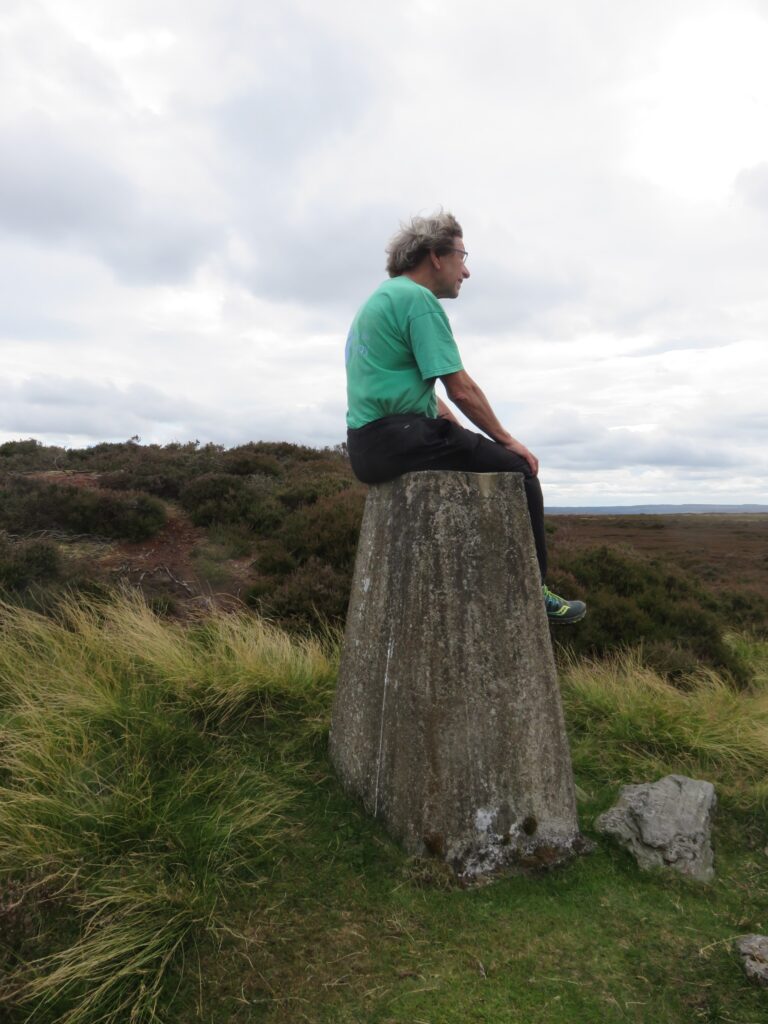
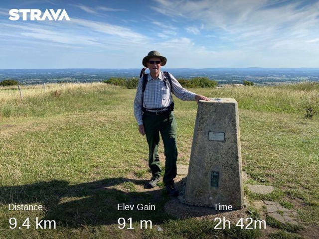
Alan Hinkes 5.86 miles 9.43km 1 trig
Sunday 26th July. The Ingleborough Bimble with Becca Humphreys. Distance 9.43 km, Elev Gain 532 m, Time 2h 24m
1 trig
Jeff Hooper 12 miles 19.3km
Saturday July 18, Circuit from Kirkby Malzeard via Laverton, 2.5 miles 12 noon to 1315, with walking stick. 6 years since I went round this. I got more satisfaction from this than many members would from walking the 3 Peaks!
Sunday July 19, In the village. Half a mile.
Monday July 20, The length of the Main Street and return. 1.25 miles. 40 mins. With walking stick.
Tuesday July 21, Shopping plus 6 laps of my garden (16 laps to the mile). 1.0 mile. With walking stick.
Wednesday July 22, Shopping and in the village. 1.25 miles. With walking stick.
Thursday July 23, Tom Corner to Stopes Bridge and return, on the track over the moor that goes from Lower Wensleyale to Nidderdale 2.5 miles. With two walking sticks this time. 1hour 20 mins.
Friday July 24, Half a mile in the garden.
Saturday July 25, The length of the Main Street and return. 1.25 miles. 40 mins. With walking stick.
Sunday July 26, The length of the Main Street and return. 1.25 miles. 40 mins. With walking stick.


Becca Humphreys 12.9 miles 20.72km 2 Trigs
Thursday 23rd July. Blencathra by Halls Ridge. Distance 11.29km, Time 3:45, Elevation gain 827m
1 trig
Sunday 26th July. The Ingleborough Bimble with Alan Hinkes. Distance 9.43 km, Elev Gain 532 m, Time 2h 24m
1 trig
Richard Josephy 42.9 miles 69km 8 trigs
I decided to visit the highest points in Oxfordshire and its 6 contiguous counties, none of which I had been to before. I devised a series of walks over 4 days to include each one plus any other nearby points of interest, plus the highest point in Hampshire which is quite close to that of Berkshire. Not all the tops have trig pillars but some have one nearby.
The aggregate height is a staggering 2417 metres, with the highest being Cleeve Hill at 330m. Aggregate distance 69Km.
Friday 17th July. Walbury Hill, Berkshire, 10Km walk including Pilot Hill, Hampshire, and Inkpen Hill.
Milk Hill, Wiltshire, 12Km walk including the White Horse (the chalk monument, not the pub) and Tan Hill.
Sunday 19th July. Bald Hill, Oxfordshire, 11Km walk including Aston Rowant Nature Reserve.
Aston Hill, Buckinghamshire, 15Km walk, including Wendover Woods and Boddington Hill iron age fort.
Wednesday 22nd July. Arbury Hill, Northamptonshire, 5Km walk.
Friday 24th July. Ilmington Down, Warwickshire, 8Km walk.
Cleeve Hill, Gloucestershire, 8Km walk including Postlip Tithe Barn, Prestbury Nature Reserve and several ancient earthworks.


Tim Josephy 86.8 miles 139.7km 21 Trigs
There are 21 trig pillars on Anglesey and Holy Island. I devised a series of walks to link them up; as many of the trigs are in agricultural areas and the old rights of way have long disappeared, I ended up doing a lot of road walking
Friday 17th July. Rhostrehewfa to Llanfaelog, via trigs Cefncwmwd, Hermon, Aberffraw, Llanfaelog. 24.5km 5hr 15. Cefncwmwd trig buried deep in a hedge, took me 15 minutes to find.
Saturday 18th July. Holyhead Mountain to Rhoscolyn, via trigs Holyhead Mountain, Tre-Arddur, Rhoscolyn Beacon. 20km 4 hr.
Sunday 19th July. Llanfachraeth to Cefni Reservoir, via trigs Graianfryn, Carmel and Hafod. 21.15km 4 hrs, all on the road.
Tuesday 21st July. Carreglefn to Bull Bay, via trigs Bryn Pabo, Mynydd Garn y Mynydd, Craig Wen. 31.1km 6hr 15. 4 cleg and 2 tick bites.
Thursday 23rd July. Llandonna to Bryn Refail, via trigs Bwrdd Arthur, Mynydd Llwydiart, Rhuddlan Fawr, Mynydd Bodafon. 25.75km 6hr 15. Then made a shorter circuit of Parys Mountain and Mynydd Eilian trigs. 6km, 1hr 30. Poured all day
Sunday 26th July. Penmynydd to Brynsiencyn, via trigs Penmynydd and Porthamel, 11.2km, 2hr


Alan Kay 29.8 miles 48km 1 Trig
Friday 17th July. North York Moors. Circular walk from Boltby via Hawnby. 26km, 820m ascent. Time approx 6 hours. One of my favourite NY Moors walks, usually unfrequented –saw two people all day. No trig points, though Hawnby Hill Crag, at a mere 298m is a fine little hill with panoramic views.
Thursday 23rd July. Wensleydale. Circular walk from Hawes via Pennine Way to Dodd Fell, Bardale Beck, Marsett, Burtersett. 22km, ascent 800m. Time 6½ hours. Another favourite walk, but thick wet mist much of the day, so no views from Dodd Fell. Bardale Beck was as attractive as ever. I walked with three friends, didn’t see anyone else all day. Trig point on Dodd Fell 668m.
Ian Laing 24.5 miles 39.5km 1trig
1. CORBAR HILL: Take Manchester Road out of the centre of town and up the hill to where Corbar Road comes in from the right. Along Corbar Road to an unmade road up on the left which leads into Corbar Wood.There are 3 options ,all steep,which join up at the highest point of the wood,where there is a gate leading to rough pasture (uphill needless to say). Walk along the bit of gritstone edge, at the left-hand end of which is the summit of Corbar Hill (437) complete with trig point and wooden cross.The grass slopes down to the other side,where there is opportunity to roam,but the best way to return to Buxton is to retrace stepsto the wood and descend by one of the two routes not used for the ascent.
2. LIGHT WOOD: To Corbar Road as with Walk 1,at the far end of which it joins Light Wood Road). Carry on up hill, with Hogshaw Brook to the right, until you reach the wood where there is evidence of water works in past times. The path goes in a roughly northerly direction and finally crosses the stream with the path going up the right to the edge of Combs Moss (Black Edge). Follow the Black Edge path to the left, which crosses the stream in Flint Clough, then down the other bank to the top of the Light Wood. Take the stile (good viewpoint/picnic site) and then ignore other paths to follow the line of the wood boundary until reaching the west end of the wood, then follow the path left which goes down to where one entered the wood on the way up.From there are various ways back to town – all downhill. (the whole round ca 5 miles)
3. East side of Burbage Edge: The start is again up Manchester Road, passing the junction with Corbar Road and the nearby hospital on the right, up to where the houses on the left more or less end – known as Nithen End. Take the path down to the left, which eventually leads to Cavendish Golf Club premises, just beyond which there is a prominent path going off to the right towards Watford Farm. Left in front of the farm and then round further up on the right side through Watford Wood up to a property known as The Beet. The 410 contour crosses the path somewhere in the wood. At The Beet turn left down a narrow lane to Plex Lodge, then right up to Plex Farm, then left over fields and woodland to Shay Lodge and the Old Macclesfield Road. Turn left and follow down to Burbage Church, after which there is a wide choice of pathways,some through the parks, or even back across to Nithen End & down Manchester Road to the centre(ca 5 Miles)
4/5 Both of these walks start on the top side of Buxton at the Market Place.
4. Follow almost the full length of Green Lane from the traffic lights on the A515 beyond the Market Place. Once beyond the entrance to Poole’s Cavern on the left, take the next path off to the left which climbs up through woods (Buxton Country Park) up to the top of the hill above tree level, (cairn-Grinlow Tower,also known as Solomon’s Temple) where there are extensive views (Axe Edge to the west). Contour across above the Grin Low Road, finally dropping down to a path going left, which leads down through further woodland to Fern House. Take a right down to more woods, Temple More and finally to the road from Harpur Hill to the A515. Go across both to a minor road going ENE, along path on r.h.s to farm & farm shop, then back down and across road to a field path leading to allotments/gardens and finally back to the A515 close to the traffic lights where the walk started.(Ca 4.5 m)
5. Same start as 4, ie Market Square down to traffic lights, but this time carry on the A515 – good footpath both sides, until coming to Fern Road going off to the right. Once beyond the houses we are on the same track/lane as we came down on walk 4, but this time going in the opposite direction. Along this to Fern House Riding establishment and up the hill across to the Grin Low Road which is crossed to a farm track leading up the hill to the right, overlooking on the left a badly contaminated stream. A well established track continues west and then north to Ladmanlow, crossing the Grin Low Road again and along the Dane Valley Way by the entrance to Grinlow Caravan Park. By-pass the entrance to this and continue across the car park, up and through the woodland and once again above tree level across and up to Solomon’s Temple. The woods east of the summit give an alternative path down to Fern Road and so back to the A515 & Market Square (4.5-5.0 m)
Adam Linford 9.3 miles 15km 1 Trig
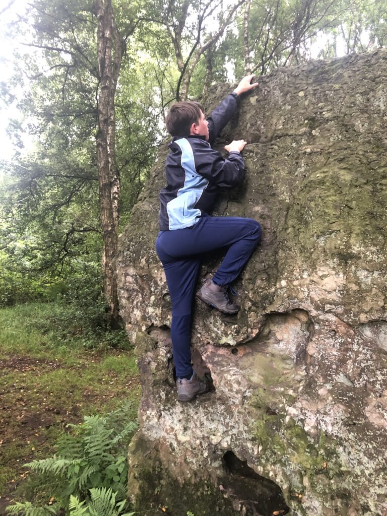
Family camping trip last weekend at Topcliffe, so took in a 15km circular from Sutton Bank to Boltby and back. Out via Gormire Lake and through the valley, and back along the ridge on the Cleveland Way. Managed to fit some bouldering en route, and I got as close as the picture shows to TP3584 before being informed I was trespassing on private property!
Alan Linford 16 miles 25.75km
North York Moors.
From Low Moor (Birk Brow), over Stanhope Moor on Quakers Causeway to Commondale, toilets open.
Up road towards Kildale tthen path to Thunderbush Moor past Hob on the Hill to Hob Cross.
Hob Cross in a sad state, it is not marked on OS maps as it is considered a border stone. Back to the Quaker Causeway, 8 miles. Most unusually, only one grouse seen on this walk, none seen in 4 days in Wharfedale..
Walk done with Michael Smith and family celebrating his 60th Birthday.
From Percy Rigg. Various parking spots used by twitchers hoping for a sight of the white tailed eagle. The farmer on Percy Rigg has had many sightings but we were not so lucky.
Down to Lonsdale Forest to Lonsdale Farm and on to Bankside Farm where alpacas, all black, are farmed. (Socks made from alpaca wool very good but make your feet black!) Many years ago YRC and CMC took part in a search of Lonsdale Forest for a missing person. Up the road towards Kildale and then onto Cleveland Way to Captain Cooks Monument , Gribdale, Little Roseberry and Newton Moor. Back by Sleddale to Percy Rigg. About 8 miles.
Rory Newman 69 miles 111km 20 Trigs
17th July. With guest Sue Thomason 3 mile circuit to collect Sleights Moor trig point .
18th July. With Sue, 6.5 mile walk to collect Louven Howe trig point. Later alone 0 miles to Potato Hill trig point (it’s 2 metres from the road !), 3 miles to Newton Mulgrave Moor trig point, and 2 miles to Skelder trig point .
19th July, With Sue 3.5 miles to collect Beacon Hill Trig Point, later alone 1 mile to collect Skerry Hall trig point.
20th July. 3 miles to collect Barton Howl (yes really) trig point
21st July With Sue 5 miles to collect Pike Hill trig point.
22nd July. With Sue 5 miles to collect Warsett Hill; later alone 2 miles to collect High Waupley, and 1 mile to collect High Boulby.
23rd July. 5 miles for Simon Howe trig point
24th July. With Mick Borroff and David Hick, 18 miles. 3 trig points en route: Whitestone Cliff, Sproxton Moor and Horcum.
25th July. With Sue, 3 miles – Cloughton trig point.
26th July. 3 miles, then with Sue 5 miles, Siss Cross, Danby Beacon and Danby Rigg trig points


Bob Peckham 🚴 39.5 miles 63.6km 🚶 28 miles 45.1km I Trig
18th July. Cycled from Inverness to Farr, Loch Farr, Tomatin and back to Inverness via Moy. Lunch in Moy churchyard. Mostly good weather but strong head winds when going west. Sighted 1 red squirrel with almost white bushy tail, 1 sparrow hawk (maybe?), 1 buzzard.
Distance cycled: 63.6km, Total ascent: 865m, Total time: 6h 6m
21st July. Walked a circular route, going anticlockwise, over Geal Charn near Laggan. Starting at Spey Dam, up Glen Markie, river crossing (no probs), up by Pipers Burn onto Geal Charn. Lunch, good views all round including to Ben Nevis/Aonach Mor. Descent down to Garva Bridge, and back along Corryairack road to starting point.
Distance walked: 22.4km. Total ascent: 716m Total time: 6h 46m
24th July. Walked from Cairngorm Ski Car Park, over to Loch Avon and Shelterstone, then up Beinn Mheadhoin (1182m). Lunch. Great conditions so decided to stay high a bit longer and walked across to Ben Macdui and its trig point (1309m). 2nd Lunch. Back down to starting point, taking westernmost path.
Distance walked: 22.7km, Total ascent: 1407m, Total time: 9h 30m.


Shaun Penny 17 miles 27km
22nd July. Unable to get involved over the weekend, so set off today from Audley back to my house in Nantwich along the Two Saints Way. (A walk from Chester to Lichfield)
No trig points but plenty of stiles, nettles and brambles. Big mistake wearing shorts, legs are really uncomfortable, (stings from the nettles). I did about 17 miles.
Anca Pordea 7.5 miles 12km
Location: Moneasa (spa destination), Arad district, Romania. Apuseni Mountains (more specifically, the mountains are called Codru-Moma). Length: 12 km Time: 4 hr
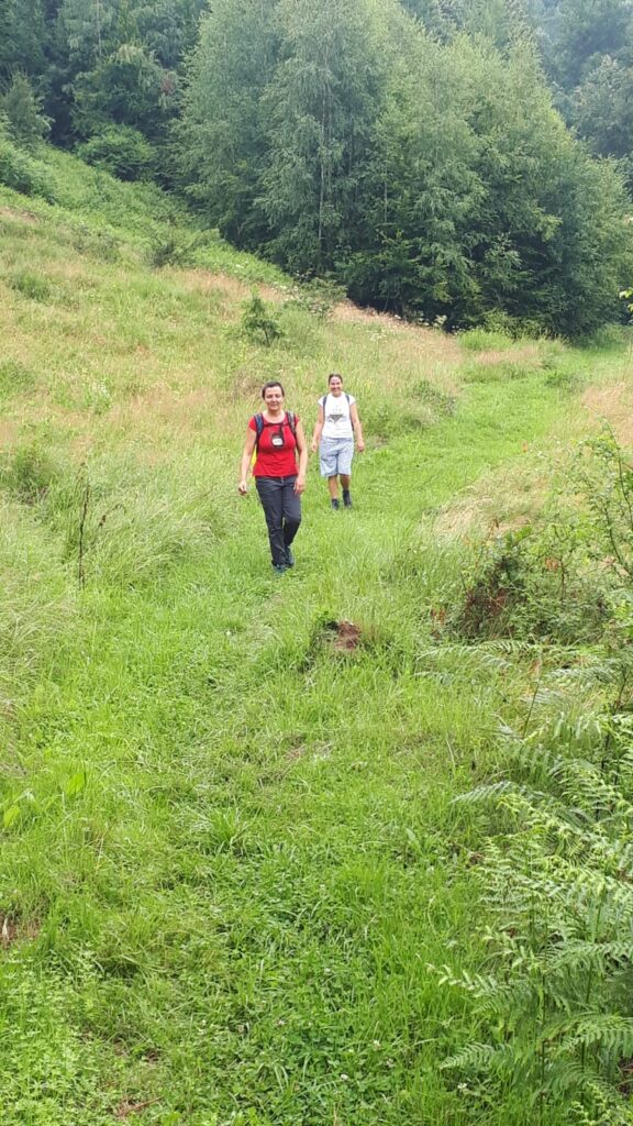
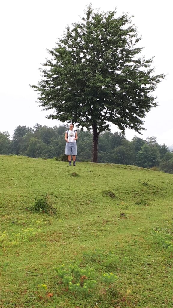
I walked with family (sister Dana and partner Sorin). We drove from Arad, Romania to the Pearl of the Apuseni mountains, Moneasa, where we did a circular walk. The initial objective was Izoiu peak (1098 m), going through Meghes valley and Tinoasa meadow, following the yellow dot markings. After going up in constant rain, they made it to the meadow where they were chased by some sheep dogs but managed to find a lovely lunch spot under a wild apple tree. Given the rain, they abandoned the peak idea and a lovely descent through the woods completed the walk.
Simon Raine 🚴 24 miles 38.6km
25th July. Cycled on the High Peak Trail. Starting at Black Rocks, went through the Hopton Tunnel, around Carsington Reservoir and return.
26th July. High Peak Trail from Minninglow to Parsley Hay and on to Pomeroy, small road back to Parsley Hay, bought farm free-range eggs, then taking the Tissington Trail to Biggin and a byway back over to Minninglow. Fell off bike next to car and smashed free-range eggs. A total of 19 miles followed by a lovely omelette.
Arthur Salmon 12.25 miles 19.73km 1 Trig
25th July With Conrad and Barbara Salmon and the Whalleys. Barbara and Conrad were with me in Leeds for the weekend and in view of the arrangements for the Long Walk we thought we’d like to contribute something. I also thought it would be nice to have more YRC involvement if possible and so asked Carol and John Whalley to join us, which they were very pleased to do. So on Saturday we met up at Middleton on the north side of the river at Ilkley and did a circular walk to near Nessfield, then up Beamsley Beacon and on to Round Hill, then returning to Myddleton Lodge to complete the circuit.19.7km, 493m ascent, 6hrs 39


Barbara Salmon 12.25 miles 19.73km 1 Trig
25th July. As for Arthur Salmon
Jack Short 31 miles 50km
My walking up to the end of June was entirely short walks with my 13 year old dog (Pippa). However, Pippa died on the 1st July after a short illness, leaving me at a loss what to do for exercise with these days of lockdown. I then thought of your efforts to produce Marathon walks. So since then I have done 5 different long walks along the “North Downs Way “ which starts at Farnham about 8 kilometres from where I live .
Each walk started by parking at a selected car park along the route. I then walked for 1 hour along the NDW and then turned round and walked back to the car . This usually meant a total of 8 km as measured on the map. I have now carried out 5 different walks solo, plus one repeated yesterday (Monday 20 July ) with my son in law and 16 year old grandson. I reckon that adds up to 50 kilometres
The walks were :-
Guildford to Saint Martha’s Hilltop Church and return .
Newlands Puttenham Common to Farnham Golf Club and return
Puttenham Golf Club to Watts Gallery Compton and return
Watts Gallery to the footbridge over the River Wey at Artington Guildford and return.
Chantries Corner Car Park to Saint Martha’s and return
Repeat of No 3 with family (They were sort of tired, but enjoyed it )
Then a short walk to fill in the gap between the Chantries Car Park and the
River Wey Bridge about 2.0 km return.
I THINK NOT BAD FOR AN 88 YEAR OLD !
Helen Smith 24.6 miles 39.65km 4 trigs
17th July. As part of a local walking group Michael and Helen each guided small groups of local friends round Win Hill above Ladybower Bridge, Shatton and Bamford mill pond. They went in opposite directions with social distancing and kept group sizes to no more than six to comply with the national restrictions. Sunny, windy. With Jim and Christine Harrison. 11.8km, 366m↑, 3.2hr.
22 July. Circuit of the Trigs of the Kinder Plateau: Walked with Michael and Richard from Edale to just beyond the Downfall (including Kinder Low Trig) to cheer them on at start of Pennine Way (well the 8 nights they have initially – they’re hoping to get far enough to have an eye test!) Then I knocked off the other Kinder trigs – Sandy Heyes and Kinder East (or Edale Moor as the OS call it) on my circuitous return to Edale. I really enjoyed it. 19.85km, 816m↑, 6.3hr.
25 July. Rivelin Valley, Sheffield, returning via the Coppice Road track. Helen Smith. 8km, 183m↑, 2.5hr.


Helen and Michael Smith 12.5 miles 20.1km 2 trigs
18th July. Morpeth Castle mound and Morpeth town centre. With Richard, & Felicity Roberts (G). 1km, 30m↑, 0.8hr.
19th July. Northumberland coast: Low Newton-by-the-sea to Dunstanburgh Castle and back. This repeated part of the long walk of several years ago along that coast. However, this time the Ship Inn had elaborate arrangements for outside 45-minute queue to place orders then another wait to the food and drinks to emerge from a separate hatch. Sunny, breezy. With Richard & Felicity Roberts (G). 8.25km, 63m↑, 1.5hr.
20 July. Chasing the site manager round Southfield estate, Morpeth, following an overnight water leak in Richard’s new house. With Richard. 1.82km, 3m↑, 0.4hr.
20 July. Beacon Hill Trig, Hebron, Morpeth. 3km, 42m↑, 0.7hr.
July 20: Shaftoe Crags Trig from the east, passing tumulus, ancient fort and Salters’ Nick. 5.4km, 81m↑, 1hr.


Michael Smith 2.5 miles 4.1km 5 trigs
18thJuly. 0630 start for a drive round to near four north Sheffield trig points in light drizzle. Skew Lane (crematorium), Greno Knoll in Greno Woods, Onesmoor in the Sheffield University environmental station, and Loxley Common (overlooking where Robin Hood was raised). 1.6km, 100m↑, 0.45hr.
21 July. Emlin Ridge trig on Bradfield Moor, Peak District. 2.5km, 98m↑, 0.45hr.
Richard and Michael Smith 102.25 miles 164.55km 9 trigs
22 July. Pennine Way 1: Edale to Laddow Rocks. Cloudy with light showers. Passing Kinder Downfall, Bealkow and Crowden. There was a diversion round the reservoir approaching Crowden on account of work being sone on the dam. Driving from Sheffield to Edale for the start the juvenile bearded vulture flew for some minutes about 100m overhead close to Ladybower bridge. Richard & Michael Smith. 34.6km, 1107m↑, 8.17hr.
23 July. PW2: Laddow Rocks to near Stoodley Pike. Passing Black Hill (Soldier’s Lump), Wessenden, Standedge, White Hill, Blackstone Edge and Warland Reservoir. Wetting vegetation initially from overnight rain then afternoon rain and a brisk wind. Camp in plantation by Withens Clough Reservoir. Richard & Michael Smith. 37.4km, 680m↑, 8hr.
24 July. PW3 Near Stoodley Pike to Cowling. Soon after crossing the Calder River and Rochdale Canal, toiling up the northern bank we meet Damian Hall running southwards downhill looking as fresh as a daisy on his way to covering the Pennine Way’s 431km in 2 days 13 hours 34 minutes on Friday evening and so beating the previous record by over three hours. We are taking rather longer to fully appreciate the delights the route has to offer. Today these included small reservoirs and Haworth’s Tip Withens. Rain due overnight so we stay at the Squirrel Wood campsite. Richard & Michael Smith. 32.8km, 950m↑, 9.5hr.
25th July. PW4. Cowling to Gargrave: Once the rain abates after 1030 we are off over fields to Lonsdale, Pin Haw Beacon trig then across moors and fields to join the canal towpath to Gargrave. After resupply at the Co-op (face-coverings now obligatory) we meet David Handley and Liz who not only provide a touch of civilisations with a roof over our heads for the rainy night, welcome hot showers, wine and nibbles. 21.1km, 561m↑, 4.5hr.
26 July. PW5: Gargrave to above Horton-in-Ribblesdale. Soon after leaving Gargrave for Malham, Haw Crag Trig was visited as it is only a couple of hundred metres off the Pennine Way. Malham was reached as a shower started so refuge was found in a tea room. Felicity Roberts met us there and accompanied us to Malham Tarn House before circling back through Gordale and by Janet’s Foss. Fountains Fell and Pen-y-Ghent followed to an adequate camping area on Rough Hill above Birkwith and Old Ing Caves. Showers throughout the day. 38.65km, 1123m↑, 8.8hr.


Derek Smithson 8 miles 12.9km
To the south of where I live in Ormesby we have a National Trust Estate consisting of some woodland where I used to walk my dogs, a farm and the manor house – Ormesby Hall. This is the scene for my exercise, almost flat with the Cleveland Hills further south, too far for me to walk these days.
So the walks start with the crossing of a busy main road, being lame in one leg adds to the sense of danger. The woods provide a shield from the traffic noise and a peaceful walk to the cornfield with its clumps of trees. Beside the cornfield is a hay field containing the abandoned cricket pitch where vandals overcame the efforts of the cricketers to maintain a pavilion. Beyond is the car park for visitors to the croquet lawn and gardens of the Hall. But I don’t get that far – yet. Nor do I reach the magnificent stables and church adjacent to the Hall.
The walks are about one mile taken slowly and usually with my daughter, which gives a grand total of eight miles between 17th and 26th July.
Tom Spencer 6.5 miles 0.46km 1 trig
26th July. Just realised I did a walk that week around the Llantysilio, nothing huge but here it is, up and down three humps to the trig point and then back around Moel y Hamelin. Spotted a fox moth caterpillar en route.


John Sutcliffe 6.8 miles 10.9km
Monday 20th July. A pleasant day out with Mick Borroff and a geologist friend Roger with his family, starting from Malham, taking in the Cove, the Watlowes, Water Sinks, Pikedaw Hill and its calamine mine, picking up odd bits of blue (azurite) and green (malachite) copper ores from the old dump and down via the neatly-walled adit portal dated 1872. 10.9km +424m, 3hr 40min.
Arthur Tallon 5.9 miles 9.47km 2 trigs
22nd July. I had a lift to Ditchling Beacon with my daughter and made a slight detour to pick up the trig point. Then on the ridge along the South Downs Way and after 2 miles another detour to take in the trig point at Blackash. After that it was down in hot sunshine towards the A27. It was not all downhill , in fact a very steep bit through a wood was quite a challenge to my ageing knees. I reached the road and had a choice, carry on up the next hill to Brighton, get a bus back home or get my daughter to pick me up. I chose the easy one and got a lift back in the car. This time my knee had had the last word. But it does leave something for another day.
Richard Taylor 10.94 miles 17.6km 1 Trig
Tuesday 21st July. A great walk with Peter Chadwick and Mick Borroff from Cotterdale to three 2000ft summits: Great Shunner Fell, Hugh Seat and Sails. Good weather and far-reaching 360 degree views extending to the Galloway Hills and Scafell, Howgills and a huge number of Dales tops. Also visited Ure Head to see the birth of the infant river. Saw a buzzard and a short-eared owl hunting voles. 17.6km, +629m, 4hr 45min.
Mike Thompson 12.4 miles 20km
Never one of the many YRC’s tigers: now often have some difficulty putting one foot in front of t’other.
By popular demand gave up biking to pick up the ‘paper on April 14 . Since then just walk – better described as limp /stagger every day down to the village : just over 1 km – there and back 2km , if that is helpful & registrable on your list. At least the coffee shops are now open in both respects : haven’t tried the pubs yet.
Kjetil Tveranger 🚴 24.85 miles 40km 🚶 31 miles 50km
In the South of France
Sunday 19th July. biking 40 km, 1,4 hours
Monday 20th July. jogging 5 km, 0,5 hours
Wednesday 22nd July. mountain walk,600m ascent, 13 km
Friday 24th July. jogging 5 km 0,5 hours
Saturday 25th July. walked up from Maison du Valier to Mont Valier. Climbed 1900m and walked 19 km. Stayed at Refuge des Estagnous.
Sunday 26th walked down 1300m to the car. About 8 km


Nick Welch 🚴 41 miles 66km 🚶 10.5 miles 16.9km
Not much walking but:
41 mile (65.98 km) cycle ride. 1,883 ft (573.94 m) elevation gain, average speed 13.1 mph (21.08 km/h) to North Aston.
Ridgeway and beech woods – a walk in the Chilterns. About 10.5 miles (16.9 km), can’t be any more precise, didn’t turn on Strava.
Carol and John Whalley 44.6 miles 71.8km 2 Trigs
17th July. Part 1 of Not the Long Walk. Holme- Black Hill circular 22.59 Km. Elevation 607 m.
21st July. Part 2 of Not the Long Walk – Last of the Summer Wine country. Holmfirth Circuit 24,5 Km, Elevation 688 m.
25th July. From Ilkley, Beamsley Beacon and Round Hill circuit. With the Salmons 19.73 Km. Elevation 491 m.
26th July. Meanwood Woods circular, 5km. Elevation 67 m.


Great effort from the club. Its good to see everyone is so active given the current circumstances 😀
Thanks Tim for putting this together. So interesting to see where everyone’s been and great photos. Special congrats to Michael and Richard. And to Arthur, still enjoying walking at 88, inspirational!
Tim, a great result thanks for putting it together.
An interesting addition to my cycle ride report – climbing the hill from Linton and near the Zoo, a young faun ran down the road towards me then tuned up a side lane. After another 200 yds approx. a group of 5 female Deer jumped out of the hedge, crossed the road and jumped the opposite hedge. Fortunately they crossed about 50yds ahead of me. This reminded me of my accident in February at 9.30pm, when a Badger darted through the nearside hedge and raced across in front of me. Travelling at about 15mph, my front wheel collided with the badger and his bulk caused my front wheel to turn sharp right, landing me face down on the road and the bike with a very bent pedal !!
Just got round to reading this report. . . still on the Pennine Way with Richard but now north of Hadrian’s Wall. That must be half a journal of reports! So many members involved in such diverse ways/places. Thanks everyone, especially Tim as compiler.
Thanks, Tim, for putting all this together. It’s great to read of our members’ typically innovative and enthusiastic approach to an unusual situation. Roll on the day when we can have a proper Long Walk.
Michael and Richard, your account of the Pennine Way brings back memories of when I did it in 2013. Don’t think I could do it now!
Just to add my thanks to Tim for putting all this together – great effort all round.