Meet Report: 7-9 February 2025.
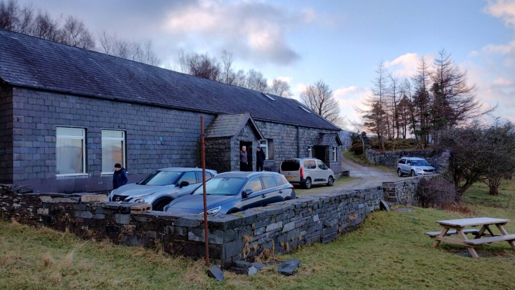
Our party of eight gathered on Friday evening at Ty Powdwr, home of the Karabiner Mountaineeering Club. Ty Powdwr sits across Llyn Padarn from Llanberis and is accessed from the village of Dinorwig via a rough track through farm buildings. The sturdy nature of the structure can be explained by the fact that Ty Powdwr translates into English as “powder house”. It was here that explosives were stored for use in the slate quarry workings that dominate the slopes of Elidir Fawr on this side of the Llanberis pass.
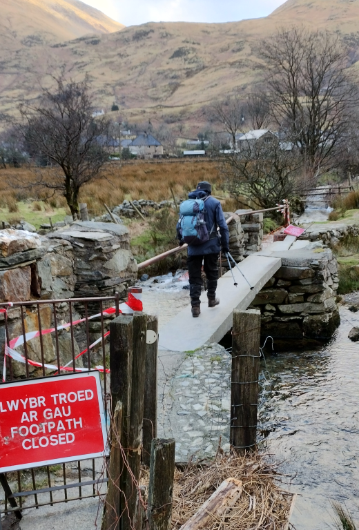
Michael and Helen had arrived earlier in the day. After a sandwich in the car by the hut, they dropped steeply down to Dolbadarn Castle, attempting the rough and intermittent path that traversed the slope above the road to Nant Peris. The footbridge below the Vaynol Arms was damaged and closed, but otherwise useable. A diagonal walk up through the vast slate quarries back up to the hut completed their 10km round.
Considering that the weather may just allow it, Mark set off to do the scramble of Crib Lem to Carnedd Dafydd, along to Carnedd Llewelyn and down Yr Elen. Despite encountering walkers beating a retreat in strong wind, he soldiered on upward as the path improved and conditions eased in the shelter of the amphitheatre of Cwmglas Mawr. However, as soon as he reached the ridge he was met with a wall of wind so strong that he could not let go of the rock. He determined to fight another day and retraced his steps back to the car.
Following breakfast on Saturday, Helen, Mark, Michael, Solvig and Stuart set off by car for Llanberis. After parking close to the Snowdon Mountain Railway terminus, they joined the popular Llanberis Path that roughly follows the railway track past Halfway House and eventually to the summit. Of note as they set off at nine in the morning, was the number of people descending so early from the mountain. It could reasonably be estimated that the average age of the descending groups was roughly half that of the YRC party of ascenders. The elder group stopped to chat with a group of enthusiastic young women, summit-frozen hair and all. Seemingly, a considerable number of walkers had set off around 5am with the aim of seeing the sun rise from the top of Snowdon. Presumably, it had been hoped that spectacular “selfies” and “TikToks” would be rewarded by a commensurate number of “thumbs-ups” and “likes” in “the cloud”. Unfortunately, it seems actual cloud had in the main frustrated any lofty social media goals. Nevertheless, their exercise had clearly been an enjoyable one and it was encouraging to see so many youthful people in the mountains.
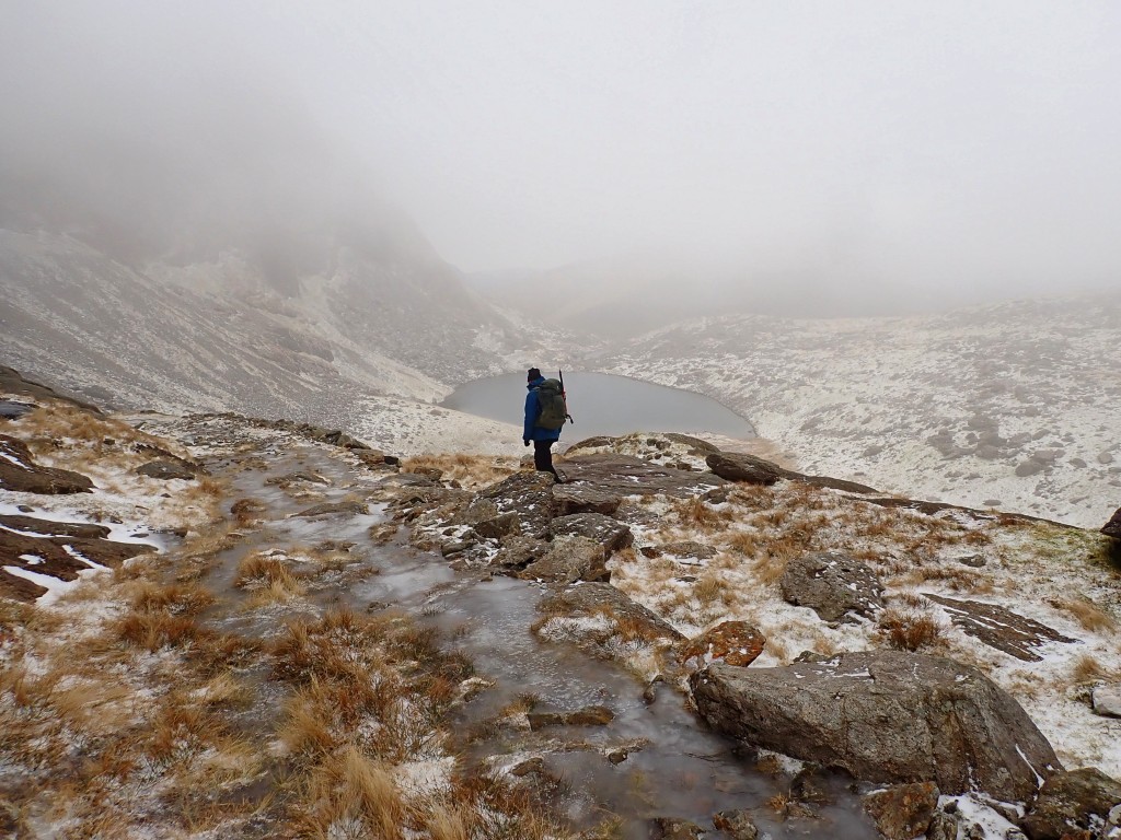
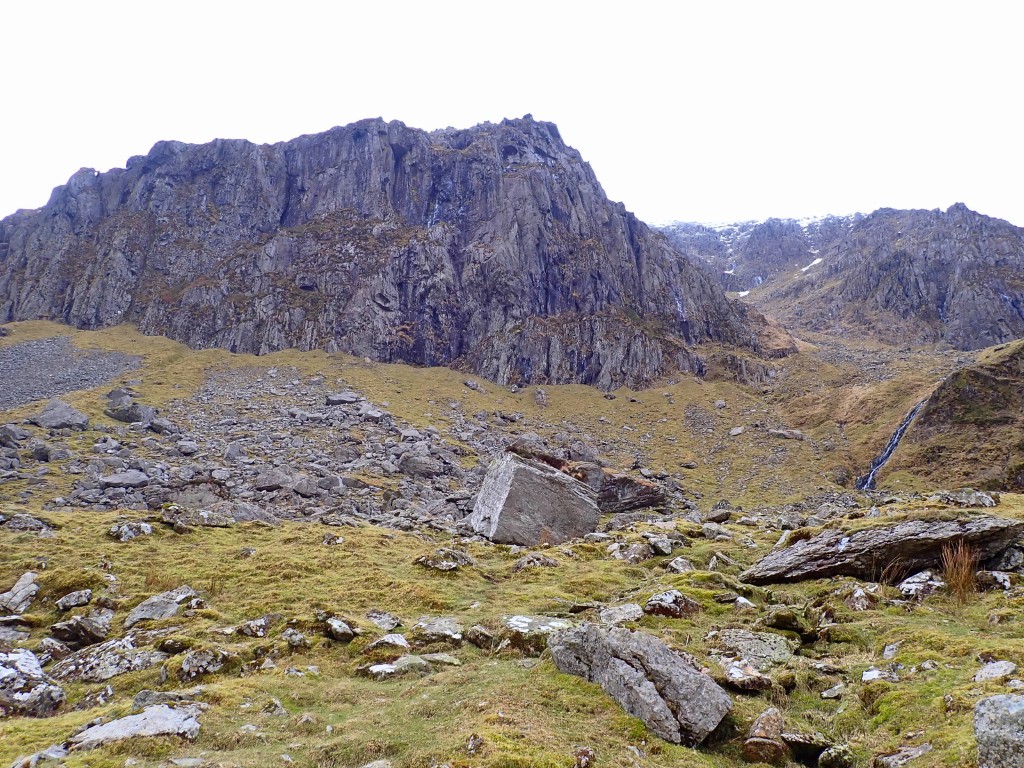
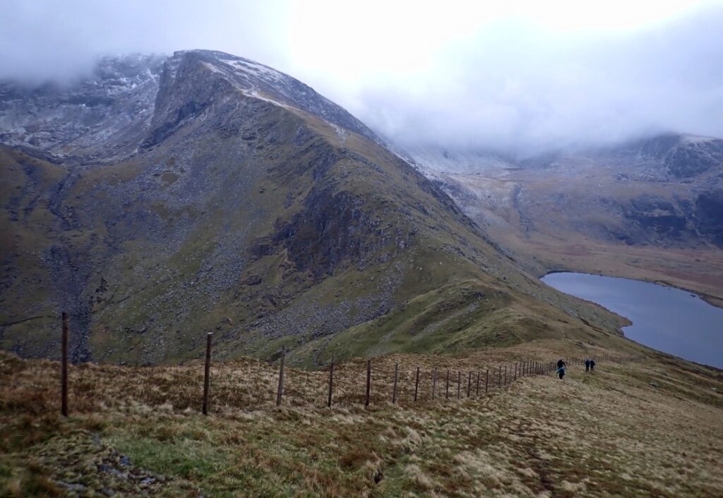
Our own party had toyed with making for the summit themselves, but aforementioned cloud at height had encouraged an alternative strategy. Thus, upon reaching Clogwyn Station, a right turn was taken and the group followed a route under the crags of Clogwyn D’ur Arddu. While the path was well marked, it was also treacherous underfoot where water running off the cliffs had frozen hard. The group distracted themselves from the difficulties of the terrain with some light-hearted but practical conversation about the many uses of the humble black bin-liner. Seemingly an appealing fashion item of a certain heritage, they had also been used (carefully) as a rain shield for toddlers carried in a backpack. Distractions notwithstanding, it was determined that dropping down to the shore of Llyn Du’r Arddu would make for safer and quicker travels. Luckily, from time to time the cloud cleared, affording atmospheric views of the impressive cliffs of legendary “Cloggy”. With no obvious path to follow, the group was careful to heed Tim’s earlier advice about becoming crag-fast as they picked their way through rocks and snow-dusted grass towards the col at the head of Cwm Brwynog.


From there, the path led northwest up an easy ridge to the summit of Moel Cynghorion. Views to the left were excellent, with the Nantlle ridge and Mynydd Mawr prominent in the foreground and the Lleyn Peninsula at the back. The broad, grassy top lends itself to pleasant walking, but a lack of rocks of any size makes for one of mountaineering’s most disappointing summit cairns. The walk back to Llanberis via Maesgwn was straightforward allowing the party the opportunity to observe some items of historical interest en route. These featured a distinctive waterworks building, a distant stone circle (again, disappointing) and something called a Burnt Mound (which the group forgot to look for). With an additional optional short walk to the end of the car park and back, the group completed a 17km route that all agreed was thoroughly enjoyable and varied in nature.
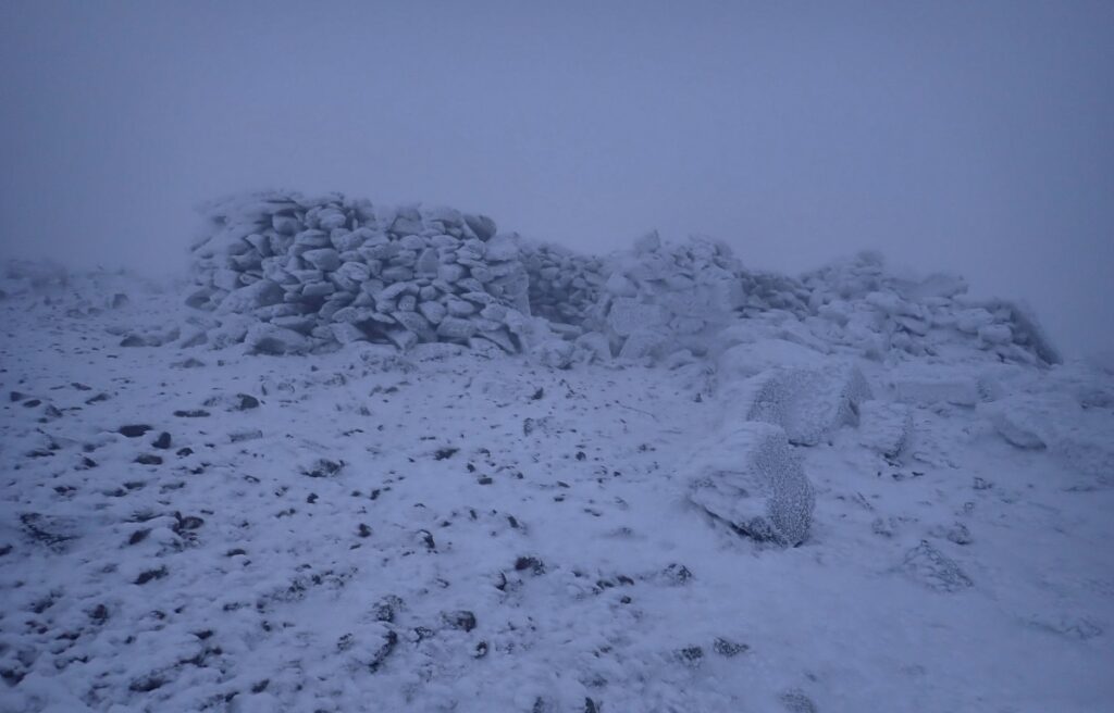
Under the lowish cloud-ceiling Tim and Peter set off from the hut heading for Elidir Fawr via the Marchlyn Mawr reservoir. Elidir apparently means in modern Welsh “discretion and reason”. However, the hill very discreetly and unreasonably re-located itself so craftily that they ended up avoiding the lake and reached the top in cloud more directly via Elidir Fach up its Southern flank. The summit traverse took patience and careful clambering with the thin dusting of slippery snow.
Descent skirting Foel Goch to the South was on an obscure track well-trodden by equine rather than ovine hooves. This was unexpected, as they had the idea that ponies are confined to the Carneddau. Wrong again. As was the public footpath suggested by the OS map which made needles in haystacks look like pikestaffs. Not many public can be using it. Luckily this rather unpleasant and increasingly grassy and steep line successfully targeted Nant Peris where a modest traditional pause was followed by re-ascent across the Dinorwic quarries to base arriving in the gloaming.
Harvey headed off for a walk to Llanberis via Anglesey Barracks. After lunch he headed towards the paths that lead through the slate mines, noting that even on a cold weekend in February, the attraction was immensely popular. One suspects that a warm summer bank holiday would see the place packed to the gunnels.
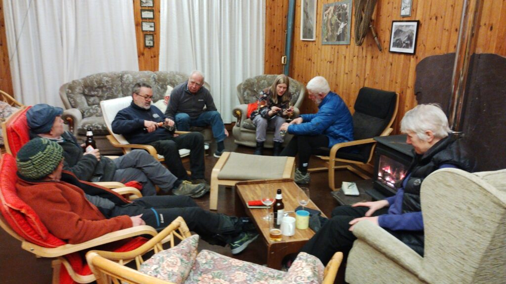
Tim treated all to an excellent supper of chilli con carne, followed by rhubarb crumble and custard. Solvig also broke out some artisan cheeses that were enjoyed with wine and beer. The large comfortable lounge made for convivial surroundings and conversation came easily to its occupants during the remainder of the evening. Solvig gave the group some helpful advice about which tense they should optimally use if they were to write a novel and Harvey revealed some hidden talents to the group. Ty Powdwr is a large, well-appointed hut and proved to be a comfortable base for the meet.
Sunday saw Mike and Helen head off early after breakfast for the airport and a week of walking in the sun on La Gomera in the Canary islands. While Solvig and Harvey headed home to Yorkshire, Tim went to Betws y Coed and cycled a circuit around Llyn Elsi and Llyn y Parc.
With a reasonable weather forecast, albeit with wind gusting to 40mph, Mark decided to give Friday’s route another go. After making quick progress up the Afon Llafar valley, he decided the walk up Mynydd Ddu ridge to Carnedd Dafydd would be a better option than the scramble up Crib Lem. However, he was blasted as he reached the col at Cwm Moch and winter conditions of snow, verglas and high wind settled in. Again, good judgement dictated that once Carnedd Dafydd summit had been reached a retreat was the best and safest option.
Peter and Stuart drove out to the Lleyn Pensinsula. Having parked up, they followed a winding path down to Nant Gwrtheyrn on the north coast. This remote village that supported the abandoned granite quarries is now home to a thriving Welsh language school. The heritage centre in the refurbished chapel is home to a fascinating museum and film show that tells the story of this singular place. (As a point of interest, in a previous incarnation as a helicopter pilot Tim flew in the roof trusses for this building as the lorries couldn’t negotiate the steep road). They then completed a circular walk following the picturesque coastal path before returning to their cars and then home to Shropshire.
Attendees: Peter Baker, Solvig Choi, Stuart Dix, Tim Josephy, Harvey Lomas, Mark Rothwell, Helen Smith, Michael Smith.
Leave a Reply